↗ View this article in the original PDF newsletter
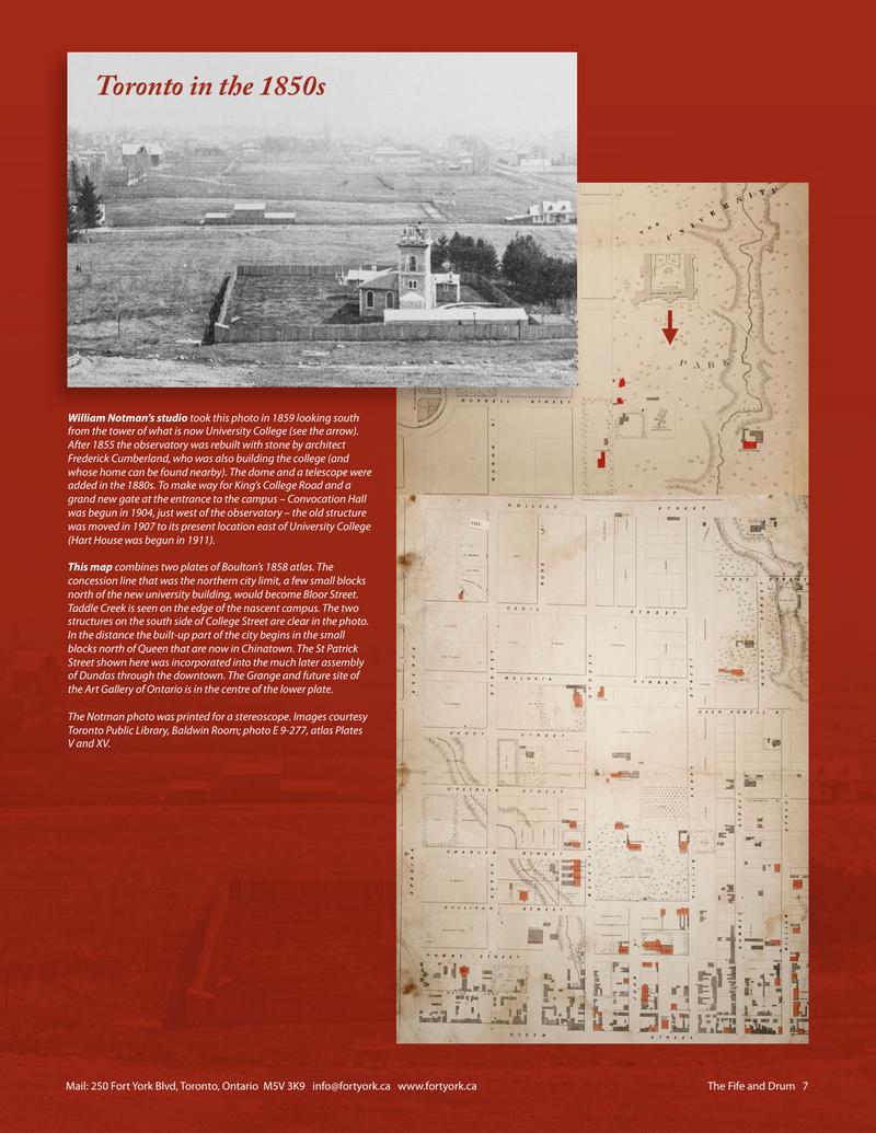
This map combines two plates of Boulton’s 1858 atlas. The concession line that was the northern city limit, a few small blocks north of the new university building, would become Bloor Street. Taddle Creek is seen on the edge of the nascent campus. The two structures on the south side of College Street are clear in the photo. In the distance the built-up part of the city begins in the small blocks north of Queen that are now in Chinatown. The St Patrick Street shown here was incorporated into the much later assembly of Dundas through the downtown. The Grange and future site of the Art Gallery of Ontario is in the centre of the lower plate. The Notman photo was printed for a stereoscope. Images courtesy Toronto Public Library, Baldwin Room; photo E 9-277, atlas Plates V and XV.
Toronto in the 1850s William Notman’s studio took this photo in 1859 looking south from the tower of what is now University College (see the arrow). After 1855 the observatory was rebuilt with stone by architect Frederick Cumberland, who was also building the college (and whose home can be found nearby). The dome and a telescope were added in the 1880s. To make way for King’s College Road and a grand new gate at the entrance to the campus – Convocation Hall was begun in 1904, just west of the observatory – the old structure was moved in 1907 to its present location east of University College (Hart House was begun in 1911).
Mail: 250 Fort York Blvd, Toronto, Ontario M5V 3K9 info@fortyork.ca www.fortyork.ca The Fife and Drum 7
Original printed pages