↗ View this article in the original PDF newsletter
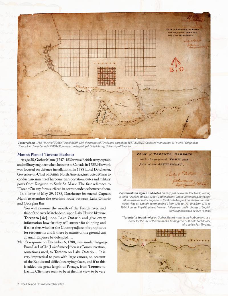
Gother Mann, 1788, “PLAN of TORENTO HARBOUR with the proposed TOWN and part Library & Archives Canada NMC4435; image courtesy Map & Data Library, University
Gother Mann, 1788, “PLAN of TORENTO HARBOUR with the proposed TOWN and part Library & Archives Canada NMC4435; image courtesy Map & Data Library, University Mann’s Plan of Torento Harbour At age 38, Gother Mann (1747–1830) was a British army captain and military engineer when he came to Canada in 1785. His work was focused on defence installations. In 1788 Lord Dorchester, Governor-in-Chief of British North America, instructed Mann to conduct assessments of harbours, transportation routes and military posts from Kingston to Sault St. Marie. The first reference to “Torento” in any form surfaced in correspondence between them. In a letter of May 29, 1788, Dorchester instructed Captain Mann to examine the overland route between Lake Ontario and Georgian Bay: You will examine the mouth of the French river, and that of the river Matchedosh, upon Lake Huron likewise Torrento [sic] upon Lake Ontario and give every information how far they will answer for shipping and if what size, whether the Country adjacent is propitious for settlements and if these by nature of the ground can at small Expense be defended…. Mann’s response on December 6, 1788, uses similar language: From Lac La Clie [Lake Simcoe] there is a Communication, sometimes used, to Torento on Lake Ontario…. It is very impractical to pass with large canoes, on account of the Rapids and difficult carrying places, and if to this is added the great length of Portage, from Toronto to Lac La Clie these seem to be at the first view, to be very
of the SETTLEMENT.” Coloured manuscript, 13” x 19½.” Original at of Toronto.

Gother Mann, 1788, “PLAN of TORENTO HARBOUR with the proposed TOWN and part Library & Archives Canada NMC4435; image courtesy Map & Data Library, University
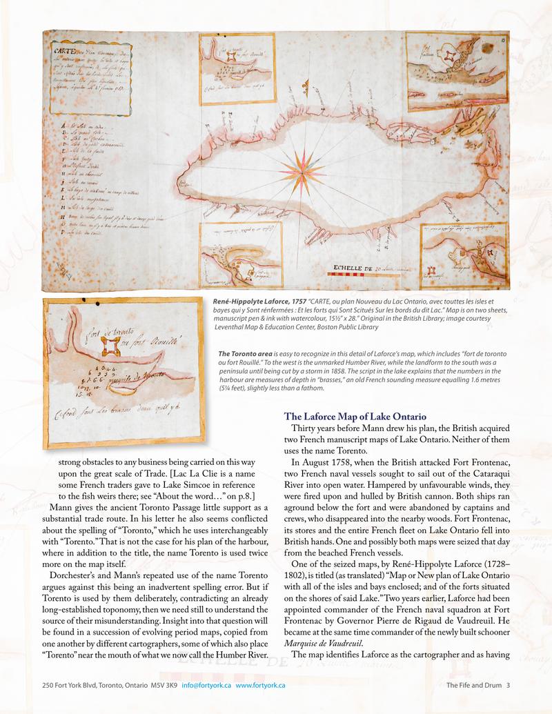
The Laforce Map of Lake Ontario Thirty years before Mann drew his plan, the British acquired two French manuscript maps of Lake Ontario. Neither of them uses the name Torento. In August 1758, when the British attacked Fort Frontenac, two French naval vessels sought to sail out of the Cataraqui River into open water. Hampered by unfavourable winds, they were fired upon and hulled by British cannon. Both ships ran aground below the fort and were abandoned by captains and crews, who disappeared into the nearby woods. Fort Frontenac, its stores and the entire French fleet on Lake Ontario fell into British hands. One and possibly both maps were seized that day from the beached French vessels. One of the seized maps, by René-Hippolyte Laforce (1728– 1802), is titled (as translated) “Map or New plan of Lake Ontario with all of the isles and bays enclosed; and of the forts situated on the shores of said Lake.” Two years earlier, Laforce had been appointed commander of the French naval squadron at Fort Frontenac by Governor Pierre de Rigaud de Vaudreuil. He became at the same time commander of the newly built schooner Marquise de Vaudreuil. The map identifies Laforce as the cartographer and as having The Fife and Drum 3
Original printed pages