↗ View this article in the original PDF newsletter
Intensive redevelopment of the largely underutilized or derelict lands surrounding Fort York and the Garrison Common continues to change the landscape of the “Birthplace of Toronto.” This is by no means a new process, as it was initiated over a century and a half ago by the railways in their efforts to transform the waterfront to suit their own purposes. There is, however, a difference between the railway and industrial developments of the 1850s through 1950s and the residential intensification of the last ten years, in that the past is no longer simply ignored and swept away without consideration or documentation.
Beginning in 2005, Archaeological Services Inc. (ASI) began working with the developers in the Fort York Neighbourhood to record the vestiges of the harbour infrastructure in this portion of the waterfront, particularly the Queen’s Wharf and other features built by the Grand Trunk and Northern railways to the south and east of the fort. Indeed, it is only because of these redevelopments that such work is possible. The most recent started in March of 2015, when preconstruction excavations began at a condominium site on Block 37, located at the southeast corner of Bathurst and Fort York Boulevard. The main objectives of the archaeological salvage excavations at the site were to record the remains of the first phase of construction of the Queen’s Wharf, circa 1833, and the subsequent modifications to the structure, which defined the entrance to Toronto’s harbour.
By early May, most of the objectives of the project had been met. The original wharf had been found, as had the subsequent 1850s modifications that resulted in a doubling of the width of the structure, along with the shore walls and lake fills that had been laid down between the mid-1850s and late 1870s to extend the rail yards south from Front Street. Similarly, other forms of cribwork required to control the flow of Garrison Creek through the new made lands into the lake had been recorded in detail.
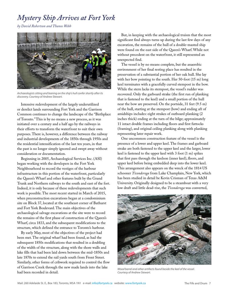
But, in keeping with the archaeological truism that the most significant find always turns up during the last few days of any excavation, the remains of the hull of a double-masted ship were found on the east side of the Queen’s Wharf. While not without precedent on the waterfront, it still represented an unexpected find.
The vessel is by no means complete, but the anaerobic environment of her final resting place has resulted in the preservation of a substantial portion of her oak hull. She lay with her bow pointing to the south. Her 50-foot (15 m) long keel terminates with a gracefully curved stempost in the bow. While the stern lacks its sternpost, the vessel’s rudder was recovered. Only the garboard strake (the first run of planking that is fastened to the keel) and a small portion of the hull near the bow are preserved. On the portside, 31 feet (9.5 m) of the hull, starting at the stempost (bow) and ending aft of amidships includes: eight strakes of outboard planking (2 inches thick) ending at the turn of the bilge; approximately 11 intact double frames including floors and first futtocks (framing), and original ceiling planking along with planking representing later repair work.
One uncommon construction feature of the vessel is the presence of a lower and upper keel. The frames and garboard strake are both fastened to the upper keel and the larger, lower keel is fastened to the upper keel with 3 foot (1 m) spikes that first pass through the keelson (inner keel), floors, and upper keel before being embedded deep into the lower keel. This arrangement also appears on the wreck of the 1814 US schooner Ticonderoga from Lake Champlain, New York, which has been studied in detail be Kevin Crisman of Texas A&M University. Originally designed to be a steamboat with a very low draft and little dead-rise, the Ticonderoga was converted, while still under construction, to a 17-gun schooner for use against the British in the War of 1812. To support the weight of the cannon and improve performance while under sail, her longitudinal stiffness had to be increased. The shipwright accomplished this by adding a second keel fastened in the same manner seen on the Queen’s Wharf vessel. It is therefore possible that the vessel found at Queen’s Wharf also started out as a steamboat and underwent a similar transformation to sail. It is also probable that she too was an American vessel. She would not, however, have seen battle on the Great Lakes. Current evidence, in the form of a US one-cent piece deliberately placed in one of her mast steps, suggests that she was built in the late 1820s. Other artifacts recovered from her bilge are consistent with this dating. It would seem that her useful service ended by the late 1870s when the shallow waters in which she lay were cut off from the lake by a crib wall and filled in over the course of the next few decades.
The identity of the ship is not yet known. Nor is it clear exactly how she arrived at her resting place beside the wharf, or why much of her structure was deliberately demolished. These questions, along with others related to her design and construction, will be subjects of ongoing research.
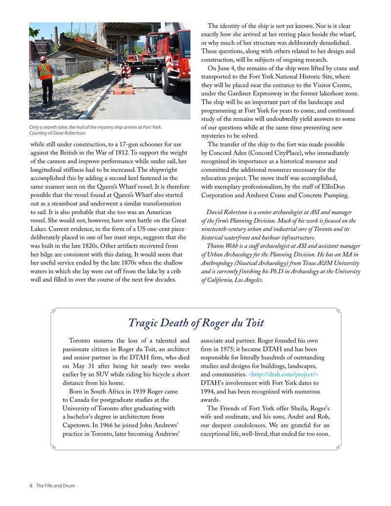
On June 4, the remains of the ship were lifted by crane and transported to the Fort York National Historic Site, where they will be placed near the entrance to the Visitor Centre, under the Gardiner Expressway in the former lakeshore zone. The ship will be an important part of the landscape and programming at Fort York for years to come, and continued study of the remains will undoubtedly yield answers to some of our questions while at the same time presenting new mysteries to be solved.
The transfer of the ship to the fort was made possible by Concord Adex (Concord CityPlace), who immediately recognized its importance as a historical resource and committed the additional resources necessary for the relocation project. The move itself was accomplished, with exemplary professionalism, by the staff of EllisDon Corporation and Amherst Crane and Concrete Pumping.
Original printed pages