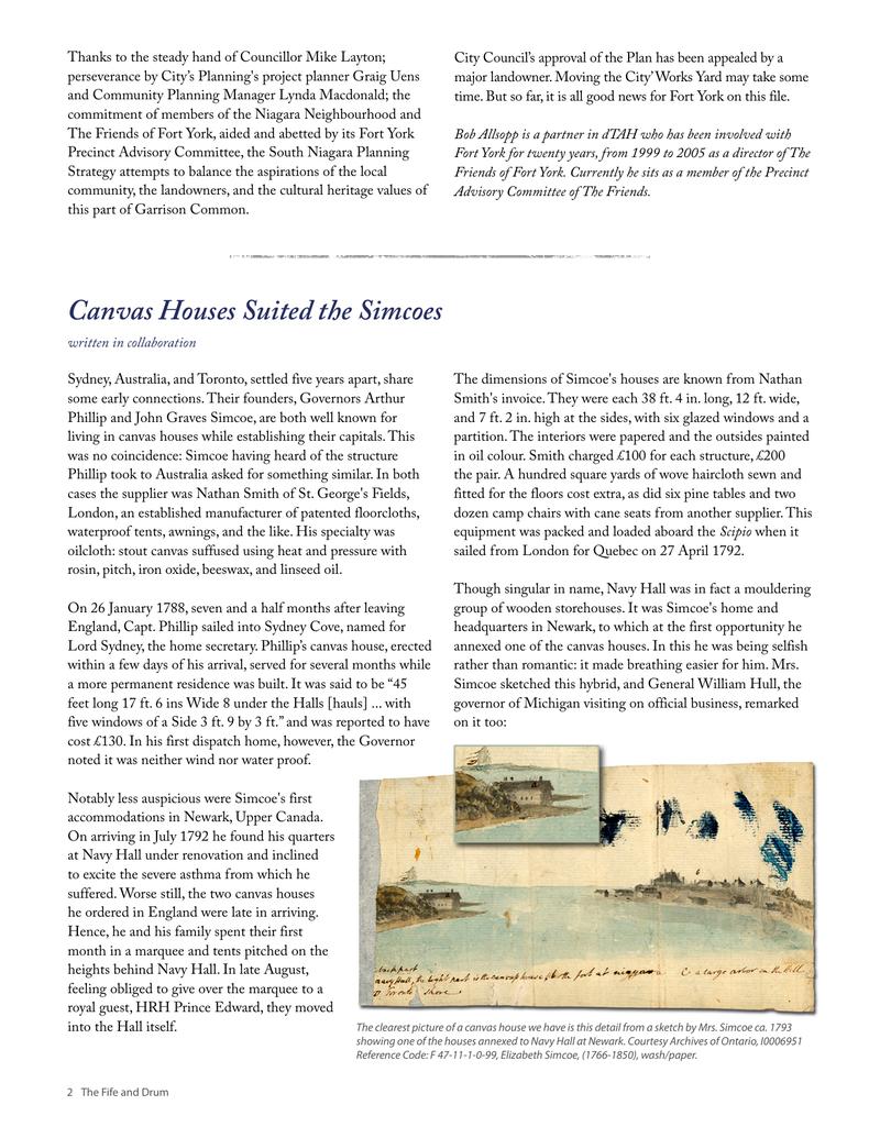
↗ View this article in the original PDF newsletter
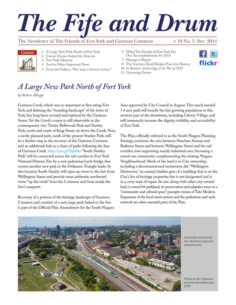
Garrison Creek, which was so important in first siting Fort York and defining the “founding landscape” of the town of York, has long been covered and replaced by the Garrison Sewer. Yet the Creek’s course is still observable in the contemporary city: Trinity Bellwoods Park and Stanley Park, north and south of King Street, sit above the Creek. Now, a newly planned park, south of the present Stanley Park, will be a further step in the recovery of the Garrison Common and an additional link in a chain of parks following the line of Garrison Creek. http://goo.gl/Yqlh8m “South Stanley Park” will be connected across the rail corridor to Fort York National Historic Site by a new pedestrian/cycle bridge that crosses another new park in the Ordnance Triangle lands. In this location South Stanley will open up views to the fort from Wellington Street and provide more authentic northward views “up the creek” from the Common and from inside the fort’s ramparts. Recovery of a portion of the heritage landscape of Garrison Common and creation of a new, large park linked to the fort is part of the Official Plan Amendment for the South Niagara
Area approved by City Council in August. This much needed 7.4 acre park will benefit the fast growing population in this western part of the downtown, including Liberty Village, and will immensely increase the dignity, visibility, and accessibility of Fort York. The Plan, officially referred to as the South Niagara Planning Strategy, envisions the area between Strachan Avenue and Bathurst Street and between Wellington Street and the rail corridor, now supporting mainly industrial uses, becoming a mixed-use community complementing the existing Niagara Neighbourhood. Much of the land is in City ownership, including a decommissioned incinerator, the “Wellington Destructor,” an unused, hidden gem of a building that is on the City’s list of heritage properties but is not designated and is in a sorry state of repair. Its site, along with other city-owned land, is zoned for parkland; its preservation and adaptive reuse as a “community and cultural space” prompts visions of Tate Modern. Expansion of the local street system and the pedestrian and cycle network are other essential parts of the Plan.

Thanks to the steady hand of Councillor Mike Layton; perseverance by City’s Planning’s project planner Graig Uens and Community Planning Manager Lynda Macdonald; the commitment of members of the Niagara Neighbourhood and The Friends of Fort York, aided and abetted by its Fort York Precinct Advisory Committee, the South Niagara Planning Strategy attempts to balance the aspirations of the local community, the landowners, and the cultural heritage values of this part of Garrison Common.
Bob Allsopp is a partner in dTAH who has been involved with Fort York for twenty years, from 1999 to 2005 as a director of The Friends of Fort York. Currently he sits as a member of the Precinct Advisory Committee of The Friends.
City Council’s approval of the Plan has been appealed by a major landowner. Moving the City’ Works Yard may take some time. But so far, it is all good news for Fort York on this file.
Original printed pages